imagined communities
web map >>/imagined-communities
on most political maps produced in modern times, nation states and other geo-political bodies are represented as homogeneous slabs that have no internal structure: the inner city of the capital is as much part of the country as its most deserted hinterland.
but what does it really mean for a country or state to be “the biggest” when large swathes of its territory are of little human interest, and therefore completely uninhabited or uncontrolled? and what does it mean for a country to have “the most inhabitants” if its population centers are separated by thousands of miles of desert?
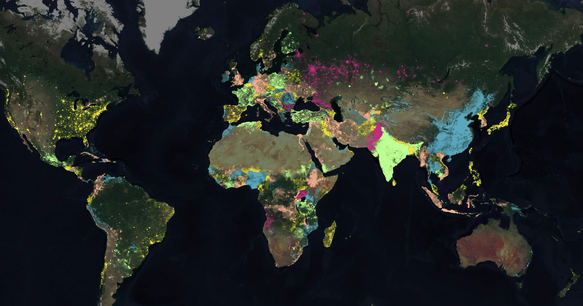
imagined communities explores a more meaningful way of conceiving of a nation in social terms, as the imagined community of all individuals who consider themselves to belong to the same nation. instead of representing a country as a uniform territory, the map only considers areas that are actually inhabited by humans, shaded according to their population density.
apart from differences in the internal structure of the world’s nations, it also reveals that not all borders are alike: abrupt ones might follow “natural” boundary features or require strict policing along awkwardly arbitrary or downright unenforceable boundary lines, while more frontier-like border regions can also be more or less penetrable in nature.